
Black Mesa
category : Natural Attractions
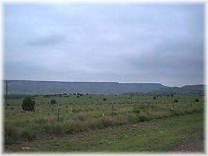 Lava from an extinct volcano created the rugged setting of the Black Mesa which is the highest point in Oklahoma, just short of 5,000 feet above sea level.
Here in the western end of Cimarron County, history is revealed with a lid some 50 to 60 feet thick, about 50 miles long, and from one-fourth to several miles in width. It is called Black Mesa (Mesa de Mayo). At its eastern end, it is about 650 feet thick, from the bottom of the Cimarron River to its basalt top. The very lid has a history of its own dating back to the Pliocene Age of about one million years. Lava and basalt flow on Black Mesa originated ten miles west of the western end, where there are three spines of igneous rock known as the Bar Seven Ell Buttes or Piney Mountain.
Black Mesa's history began millions of years ago when pre-historic beasts like the 65 foot-long brontosaurus, who skeleton was discovered here, roamed the area. Petrified logs, displayed in the park, are remnants of another era, also millions of years past. Primitive man entered the picture, according to scientific theory, some 10,000 to 12,000 years ago, and cliff dwellers are thought to have lived in the caves near Black Mesa 1500 to 2000 years ago.
Coronado and his Spanish exploring expedition crossed the area. An inscription "Coronatto, 1541, " in old Castillian style and spelling, is carved upon a canyon wall. Its eroded condition upholds its authenticity.
The famed Santa Fe Trail crossed this corner of the Panhandle during its colorful 62 years of life, and over it passed wagon trains and thousands of travelers between Independence, Missouri and Santa Fe, New Mexico. The remains of old Fort Nicholas, established by Colonel Kit Carson for protection of travelers from hostile Indians, are still to be found southwest of the park area, near the New Mexico State line. The Panhandle became part of Oklahoma territory in 1890 and the State in 1907.
The fascinating past is revealed by Indian writings and pictographs. These crude writings and pictures show the daily life of the pre-Columbian Plains Indians and the animals they hunted.
Remnants of pumpkin vines and ears of corn support a theory that this was one of the earliest agricultural areas in the United States, cultivated during the time of Christ. Some experts believe the petrified logs found in abundance may be parent trees to the present giant Redwoods of California.
 Black Mesa Geology ...
Excerpts from J.W. Hadden, for the Boise City News, 1968.
The surface slopes away from the igneous spines in all directions and at a distance it is plainly seen that they are the highest point of a great hill some five miles across at its base and roughly circular in outline. The rocks found on these slopes and in the spines are massive vesicular red and black basalt. This physiographic evidence points to the fact that these spines or vents are the source of the lava forming the cap of Mesa de Mayo. The present mesa top was once the lowest point of the area, as the hot lava followed such a depression.
This lava top thus covered the lower pages of history. The erosion, on the other hand, outside this protective cover, has laid bare in the perpendicular walls of the mesa in the lower or earlier formations which preceded the lava age. In order to arrange various ages protected by the lava cap we will start at the earliest age shown by erosion. Based on the Red Beds or Permian is the Morrison formation. Next up the scale is the Purgatoire, followed by the Dakota Formation. All three are classified as being within the Mesozoic age.
The Morrison structure is up to 50 feet thick and was laid down in a period starting 180 million years ago. During the build-up of this formation there were sluggish streams, swamps and lakes, all of which produced a vegetation of giant palms called cycads, conifers, and ferns. This lush growth of vegetation brought in giant dinosaurs and similar types of reptiles and animals. Under the supervision of the late Dr. J. Willis Stovall of the University of Oklahoma, more than 6000 bones of such a giant were excavated from a pit near Kenton and classified as members of a diplodacus. Also found in the formation were bones and tusks of giant elephants and massive jaws with broad rows of teeth running crosswise of the jaws, which indicated the vegetable-eating types of animals existing at that time.
Overlying the Morrison is the Purgatoire formation. The lower division is white to cream colored sandstone. At places where the overlying Dakota sandstone forms cliff, there is a covered slope from 30 to 60 feet, but where glimpses of the rock are possible it is found to be black shale and sometimes thin bedded sandstone or black sandy shale. Below this slope lies a thick bed of sandstone 20 to 50 feet thick. In most places this layer is white, the top of which is taken as the top of the sandstone member. This member comprises the lower 200 feet of the formation and is characterized by thick white beds of sandstone which are so prominent in the western part of the Cimarron Valley.
Address: 35 miles northwest of Boise City on Highway 325; 5 miles north of Kenton
Come visit us in Boise City, Oklahoma