Cimarron National Grassland Trails
category : Trails
 The Cimarron offers many types of terrain that suits the activity level of most any hiker.
The Companion Trail parallels the Santa Fe National Historic Trail for 19 of the 23 miles of the original trail, the longest potion of the historic trail located on public lands. The Companion Trail closely follows the existing remnants of the Santa Fe Trail from 0 to 150 feet, and consists of a grassy trace across the prairie. Sagebrush and cacti have been removed to make the trail sufficiently evident to the hiker without noticeably altering the prairie vistas. Along segments where the historic Trail is no longer evident due to erosion or agriculture, the Companion Trail overlays the true Trial location. In segments that contain actual Trail remnants or ruts, the Companion Trail is set to the side to preserve and protect the historic Trail.
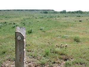
The staff of the USDA Forest Service has marked the archeologically correct route of the Santa Fe Trail as it crosses the Grassland. The Santa Fe Trail served as a primary trade route between Franklin, MO and Santa Fe, NM during the mid-1800\'s. As visitors approach the area of the Trail, they will see old limestone fence posts planted in the ground at intervals; these posts mark the actual path of the Trail. The posts are situated so that viewers can stand at one post and look across the prairie to see the next progressive post along the Trail.
The terrain varies between primarily flat prairie land, occasional draws, and the relatively gradual incline up to and down from Point of Rocks, classified as Easy to Moderate. Each end of the Companion Trail contains a trailhead with parking, unloading, watering, and stock tying facilities, handicapped mounting/dismounting facilities, and restrooms.
Motorized vehicles are not permitted on this trail. Use is limited to bicycle, foot, wheelchair, horse, draft and pack stock, and wagon travel. The trail is not paved, compacted or leveled, and is sandy in some places.
The eastern terminus of the Companion Trail is the Conestoga Trailhead located 3 miles east of the Wilburton Crossing on FS 600 (FS 600 parallels the Cimarron River to the north side), then 2 miles north
Western terminus is the Murphy trailhead, about 7 miles west of highway 27 on FS 600. To reach the Murphy trailhead, take FS 600 west where it crosses highway 27. Follow for approximately 7 miles the trailhead is on the north side of FS 600.
The Turkey Trail is approximately a 10 mile hike beginning at the Cimarron Picnic Area on Highway 27. Named for the large flock of wild turkey present, the trail meanders along the flat-to-rolling terrain along the corridor of the Cimarron River, providing many opportunities for viewing wildlife, particularly birds, different varieties of vegetation and camping.
Opportunities for birdwatching abound along this wooded easy to moderate trail; and the Cimarron Recreation Area, Mallard Pond and Wilburton Pond offer fishing as well. Potable water is available at both the Cottonwood Picnic Ground and the Cimarron Recreation Area. Hikers are advised to carry their own water. Livestock are not permitted within the Cimarron Recreation Area or the Cottonwood Picnic Ground. Camping is available at the Cimarron Recreation Area. Motorized vehicles are permitted on this trail, along with pedestrian, horseback, pack stock, and bicycle travel.
Access is north of Elkhart on Highway 27 at the Cottonwood Picnic Grounds (just south of the Cimarron River Bridge). Vehicles may be parked at the Picnic Grounds. Some visitors choose to pick up the Turkey Trail at the Cimarron Recreation Area, 4 miles east of Highway 27 on FS700 (South River Road). Restrooms are available at the Cottonwood picnic Ground and the Cimarron Recreation Area.
Phone: 620-697-4621
Our Website:www.fs.usda.gov/detail/psicc/about-forest/districts/?cid=fsm9_032733
Come visit us in , Kansas