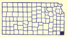
Cherokee County, KS
 Cherokee County is located in the territory that was part of the Louisiana Purchase in 1803. The area was then set out as the 'Neutral Lands" in a treaty with the Osage Indians in 1825. This 25 miles east- west by 50 miles north-south on the west of the Missouri border and east of the Osage Reservation was to be a buffer zone. Hunting, fishing, mineral extraction were allowed with no settlement of either white or Indians.
When the Cherokee Nation was relocated to the west from Georgia in 1835 they wanted more land. The Federal Government purchased from the Osage this 800,000 acres which then became known as the "Cherokee Neutral Lands".
The Kansas Territorial Legislature included the area in the setting of boundaries of the state in 1855. The southern boundary was to be at the 37th parallel and the area was named McGee County in 1860. Upon Kansas Statehood, January 29,1861, the area was 24 miles west by 50 miles north with the name changed to Cherokee County.
During the Civil War the Cherokee Indians sided with the south and believing they had ownership of the land, sold it to the Confederacy for $250,000 in Confederacy money, plus providing two companies of soldiers. This was to present a great deal of conflict over the title to the land.
Explore Cherokee County
Black Dog Trail Marker
Located on the grounds of the Historical Museum, the marker commemorates the Black Dog Trail opened in 1803 by Chief Black Dog ( Manka - Chonka) and his band of Osage Indians who had a village nearby where springs once flowed freely.
Baxter Springs, KS Historical MarkersDAR Marker
Erected by the Baxter Springs Chapter of the DAR in 1931, the marker is dedicated in Memory of Gen. James G. Blunt and his escort who, defenseless fell victims to the inhuman ferocity of guerillas, led by the infamous Quantrill in his raid upon Baxter Springs, October 6, 1863, in which 135
Baxter Springs, KS Historical MarkersHistoric Bridges
* Rainbow Curve Bridge just north of town is the only remaining Marsh Arch bridge on Rt. 66. * The InterUrban Street Car Bridge spans the lazy banks of the Spring River.
Baxter Springs, KS Historic BridgesBig Brutus
One of the most unique day trips in Southeast Kansas is to Big Brutus, 11,000,000 pounds of fun! Big Brutus is the world's second largest electric mining shovel. Walk through its cavernous body, sit in the operators chair or climb 16
Columbus, KS One Of A Kinds1919 Seth Thomas Clock
The clock was originally purchased through public donations as a war memorial for servicemen from Cherokee County who had served in World War 1. The giant Seth Thomas 1919 model clock was placed in the tower of the 1889 courthouse. In 1955
Columbus, KS ArtifactsTri-State Marker
See the Tri-State Marker and be in three states at once! The meeting point of Kansas, Oklahoma, and Missouri is 6 miles east of Baxter Springs on Highway 166/400. Turn south on the small paved road just west of the state line, and continue to the dead end. Built in 1938
Baxter Springs, KS Geographical MarkersLog Cabin
The log cabin was built east of the Lowell Cemetery in the 1870s. R.A. Hibbard built it as a home for his brother-in-law's family. Kent Lynch purchased the property and donated the cabin to the Historical Society in memory of Marsah Moncrief Lynch. In 1987
Baxter Springs, KS Pioneer HistoryLittle League Baseball Museum
This museum displays many awards and memorabilia of local sports heroes such as Mickey Mantle and Hale Irwin and other stars a Yogi Berra, Whitey Ford, Bill Russell, and other.
Baxter Springs, KS MuseumsColumbus Wye and Frisco Caboose
The Columbus Wye is a one of its kind three way switch allowing trains to turn around. The crossing, formerly located in the northern part of Columbus was donated to the City of Columbus by the Burlington Northern Railroad. At the time the switch was constructed, it was one of the three built:
Columbus, KS Railroad HistoryRiverside Park
Riverside Park is located at the east edge of Baxter Springs on Spring River on the south side of Highway 166
Baxter Springs, KS Recreation