Lake of the Ozarks Trails
category : Trails
 For a different perspective of Ozark nature, the Lake offers outstanding hiking, biking and walking trails, several of which are located at two state parks. The 17,000-acre Lake of the Ozarks State Park is the largest in the Missouri Park system, and Ha Ha Tonka State Park, one of the state's most diverse parks, features the ruins of a turn-of-the-century castle.
Ha Ha Tonka State Park
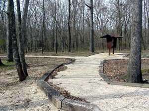
Fifteen miles of trail traverse the Ha Ha Tonka State Park, leading visitors to spectacular scenery, natural wonders and the famous castle ruins. Trails vary from accessible, paved walkways to rugged, rocky trails providing a diverse experience for hikers.
Castle
Trail - � mile (one way)
Overlooks near the castle provide views of Ha Ha Tonka Spring and the
Lake of the Ozarks. Mild terrain.
Quarry
Trail - 2 miles
Starts by the castle and leads to open views of the lake and two old quarries.
Moderate terrain.
Dell
Rim Trail - � mile (one way)
This wooden boardwalk begins near the water tower and descends a series
of steps to an overlook above the Whispering Dell Sinkhole. The step portion
of this trail is strenuous. The steps continue to the spring below.
Colosseum
Trail - � mile
Starts at the natural bridge parking lot. The trail winds under the natural
bridge and through a large sinkhole (the Colosseum). Moderate terrain.
Spring
Trail - 1 � miles
Starts at the spring/lake parking lot. One-way distance to the spring
is one-half mile, mostly paved. Wooden stairs lead above the spring bluff
to the old post office. The step portion of this trail is strenuous.
Island
Trail - � mile
Making a loop around the island and past the balanced rock, this trail
starts at the millrace (on the Spring Trail). Rugged terrain.
Boulder
Ridge Trail - 1 � miles
Begins at the Spring Trail trail head. The trail passes through an area
of large lichen-covered boulders along a ridge. Moderate terrain.
Park at the lot east
of Hwy. D, between the park's castle and spring entrances for the following
trails.
Oak
Savanna Interpretive Trail - 450 feet
This is an accessible trail with four interpretive stops.
Acorn Trail
- � mile
Prescribed burning helps maintain this open woodland. A brochure and eight
interpretive stops tell more about this savanna landscape. Moderate terrain.
Devil's
Kitchen Trail - 1 mile
Visit unique geologic features, including Devil's Promenade. Rugged terrain.
Turkey Pen
Hollow Trail - 7 miles
Backpack camping is allowed on this trail that winds throughout the Ha
Ha Tonka Savanna Natural Area. Rugged terrain.
Lake of the Ozarks State Park
Woodland Trail -- 6 miles
Beginning and ending behind the trail center, Woodland Trail meanders quietly through the Patterson Hollow Wild Area. This area provides a diversity of habitats ranging from old fields to dense oak-hickory forests, dry streambeds to spring-fed seeps, and nearly barren ridge-tops to lush ravines. The trail is signed in a counterclockwise direction with blue arrows and has two connector trails that allow for shorter hikes of two miles or four miles. This trail is intended for hiking and backpacking use only. All backpackers should register at the park office or trail head before using the trail. A primitive camping area is located along the trail for backpackers.
Trail of Four Winds -- 6 miles
This trail is open to hikers, equestrians and all terrain bicycle users. The entrance for equestrians is on the north side of the riding stables. The entrance for the hikers and bicyclists is along Highway 134 two miles from the park entrance. The blue loop, 3.2 miles long and signed in a counterclockwise direction, takes trail users near the lake for part of its length. The yellow loop, 4.1 miles long and also signed in a counterclockwise direction, leads to an unusual rock formation covered with lichens and mosses. A boardwalk for foot traffic only gives access to the rocky outcrop that provides a scenic vista of the valley below. A red connector trails provides an alternate route that shortens the yellow loop by .6 mile. Those wanting to visit only the overlook can do so by following the yellow arrows to the site and returning by the same route following the blue arrows. It is 1.3 miles one way from the trail head to the overlook. Directional arrows mark all intersections.
Squaw's Revenge Trail -- 2 miles
Squaw's Revenge trail originates directly across the highway from the riding stable entrance. It is signed with green arrows in a clockwise direction. At one point, from atop a high bluff, the trail user is presented with a dramatic view of the Grand Glaize arm of the Lake of the Ozarks. Both equestrian and hiking use is permitted on this trail. The trail is used for regularly scheduled horseback rides from April through October. If you meet a group of riders, please move off the trail, stand quietly and let them pass.
Lazy Hollow Trail -- .5 mile
This hiking trail is located directly across the highway from the trail center. It traverses a typical Ozark hollow, and can provide a pleasant experience for those interested in a shorter and easier hike. It is signed with green arrows.
Fawn's Ridge Trail -- 2.5 miles
This trail has two entry/exit points, one approximately 900 feet from the campground registration booth down Lake View Bend Trail and the other across the highway from the picnic area near the riding stables. The trail has two sections: the southern, marked with yellow arrows, and the northern, mark with blue arrows. Both are signed in a counterclockwise direction. This trail is open to hikers only.
Lake View Bend Trail -- 1 miles
Lake View Bend Trail begins at the campground registration booth and ends in Campground 4. The trail meanders along the base of steep cliffs near the lake. This hiking trail is point-to-point so users must return by the same route or hike through the campground. This trail is the best in the park for viewing spring wildflowers in April, May and June.
Rocky Top Trail -- 3 miles
This trail is located at Grand Glaize Beach and begins across the road from the picnic shelter. It features a natural glade, a scenic overlook of the lake from atop a towering bluff, and distinct contrasts in plant communities on dry south-facing slopes and moist north-facing slopes. The trail is a figure eight, each loop being 1.5 miles long. Only hiking is allowed on this trail.
Shady Ridge Trail -- .5 mile
Beginning at a picnic area near the boat launch at Grand Glaize Beach, this trail winds along the lakeshore. It then climbs to a small glade before it turns west and connects to an old road that leads back to its starting point. The trail is intended for hiking only.
Coakley Hollow Trail -- 1 mile
This self-guiding interpretive trail begins and ends at Ozark Caverns. A boardwalk provides access to Coakley Hollow Fen, a designated Missouri Natural Area. Also featured along the trail is a natural glade and a dam and mill site. Trail booklets are available at the Ozark Caverns visitor center. The trail, identified with yellow arrows, is open only to hikers.
Grand Glaize Trail -- 2.5 miles
This hiking trail begins and ends just north of the service area between Ozark Caverns and McCubbin Point. The trail crosses a diversity of habitats and is signed in a counterclockwise direction with yellow arrows.
Aquatic Trail
Lake of the Ozarks Aquatic Trail, located on the Grand Glaize arm of the lake, explains some of the lake's prominent natural features. The trail, which is approximately nine miles long, is located between Public Beach No. 1 and the Grand Glaize Beach. Each stop is marked with orange and white buoys, which are lettered consecutively. It will take about two hours to complete the trail and self-guiding booklets can be obtained at the park's visitor center.
Phone: 573-348-1599
Our Email: locvb@usmo.com
Our Website:www.funlake.com
Come visit us in Lake Of The Ozarks, Missouri