Guadalupe Mountains Trails
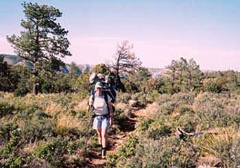
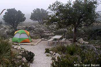
With over 80 miles of hiking trails and 10 backcountry campgrounds, Guadalupe Mountains National Park offers outstanding backpacking opportunities. All backpackers must obtain a Free Backcountry Use Permit, and must pay an entrance fee prior to entering the backcountry. All trips require preparation. Improper equipment, poor conditioning and disregard for unpredictable weather changes can result in an unpleasant or dangerous outing. Respect for the land you hike through will protect the park for you and future visitors.
Pine Springs Trailhead
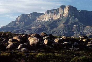
Guadalupe Peak Trail
On a clear day, the view from the "Top of Texas" (8,749 feet, 2,667 meters) is outstanding. The trail is very steep, but is well established. Some areas are exposed to cliff edges. Rated strenuous; 3000 feet of elevation gain. Round trip is 8.4 miles, and takes 6-8 hours. Avoid the Peak during high winds and thunderstorms.
Devil's Hall Trail
Hike the streambed of Pine Springs canyon, then climb the natural rock of the Hiker's Staircase, to the finale - the Devil's Hall. This rocky trail has very little elevation gain, and leads you through maples, ponderosa pine and many plant varieties of the Chihuahuan desert. The trail is rated moderate; though it is only 4.2 miles round trip, allow 3-5 hours to enjoy this hike.
The Bowl
A beautiful coniferous forest of pine and Douglas fir covers the high ridges and canyons, and awaits those who are willing to hike up 2500 feet from the Chihuahuan desert below. The remnants of wildland fire are still evident along sections of the trails. From Pine Springs campground, follow the Frijole Trail, and Bear Canyon Trail to the top, then left on the Bowl Trail. Take a side trip to Hunter Peak, then descend via Tejas Trail. This hike is rated strenuous. Allow 8-10 hours; round trip is 9.1 miles.
El Capitan/Salt Basin Overlook Trails
The trail leads through Chihuahuan desert to the base of El Capitan at the southern end of the Guadalupe mountian range. Follow the El Capitan Trail and the Salt Basin Overlook Trail. Return to Pine Springs campground via the El Capitan Trail. Beyond Salt Basin Overlook, the trail continues to Williams Ranch historic site, an additional 4.7 miles one-way. This hike is rated moderate; it is 11.3 miles round trip. Allow 6-8 hours.
Frijole/Foothills Trails
The Frijole and Foothills trails make a connecting loop between Pine Springs campground and Frijole Ranch. Start at either end. Observe Chihuahuan desert vegetation and nice distant vistas. Not frequently traveled, this trail offers an enjoyable walk of solitude.
McKittrick Canyon Trailhead
McKittrick Canyon Trail
Follow an intermittent stream through the desert, transition, and canyon woodlands to the historic Pratt Lodge, Grotto picnic area, and Hunter Cabin. A guide book is available at the McKittrick Canyon Contact Station or the Headquarters Visitor Center. Rated moderate; the 4.8 miles round-trip to Pratt Lodge takes 2 hours; allow 3-5 hours round-trip to hike to the Grotto and Hunter Cabin.
To protect this fragile environment you are required to stay on the trail, and please, stay out of the water. It is reserved for the wildlife.
McKittrick Canyon Nature Trail
An intermittent seep lies hidden within junipers, shrubs, and grasses that cling to this tiny ecosystem. Trailside exhibits describe common plants, reference wildland fire, and explain Permian Reef geology. The trail is .9 miles round trip, is rated moderate, but takes less than one hour to complete.
Permian Reef Trail
For serious geology buffs, this trail has stop markers that can be used with a comprehensive geology guide, available at the park's Headquarters Visitor Center. There are excellent views into McKittrick Canyon from the top of Wilderness Ridge. The trail is 8.4 miles round-trip, rated strenuous with 2,000 feet of elevation gain.
Headquarters Visitor Center Trailhead
The Pinery Trail
Travel the short .75 mile path to the ruins of the old Pinery Station, once a favored stop on the original 2,800 mile Butterfield Overland Mail Route. Trailside exhibits describe Chihuahuan desert vegetation. The trail is paved, rated easy, and wheelchair accessible. Pets are allowed on leash.
Frijole Ranch Trailhead
Smith Spring Trail
Look for birds, mule deer, and elk as you walk this loop trail to the shady oasis of Smith Spring. Take a break here and enjoy the gurgling sounds of the tiny waterfall before continuing around to sunny Manzanita Spring. Scars from wildland fires of 1990 and 1993 are evident along the trail. The trail is rated moderate, with a round-trip distance of 2.3 miles. Allow one to one and a half hours.
Please: Water is precious for park flora and wildlife species. Do not disturb the water in any way.
Frijole/Foothills Trails
The Frijole and Foothills trails make a connecting loop between Pine Springs campground and Frijole Ranch. Start at either end. Observe Chihuahuan desert vegetation and nice distant vistas. Not frequently traveled, this trail offers an enjoyable walk of solitude.
Dog Canyon Trailhead
Indian Meadow Nature Trail
A free trail guide offers information and insights on the natural history, and cultural history of the meadow and the surrounding area. The trail is .6 mile; at a leisure pace it takes 30-45 minutes. The trail is rated easy as it remains almost level after crossing an arroyo.
Marcus Overlook
Follow the Bush Mountain Trail to Manzanita Ridge. Once on top, the trail abruptly levels off for a short distance. Stop at the point where the trail drops steeply, and enjoy the view down West Dog Canyon. Turn back here and return to Dog Canyon along the same route. The trail is rated moderate and the distance is 4.5 miles.
Lost Peak
Follow the Tejas Trail through open meadow and into the canyon bottom, that is lined on either side by alligator juniper, ponderosa pine, chinkapin oak and big tooth maple. Shortly ahead you will begin climbing up toward Lost Peak, gaining 1540 feet in elevation. At the summit the trail levels out and soon reaches a junction with the McKittrick Ridge Trail. The distance to Lost Peak and return is 6.4 miles. It is rated moderate to strenuous, and takes 5-6 hours.