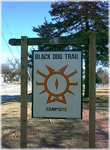
Black Dog Trail Marker
The Osage Indians were a dominant population in what was to be Southeast Kansas, and their influence had a positive effect on Caney. Chief Black Dog cleared a trail 30 horses wide, starting at the Osage camp where Baxter Springs, Kansas, is now located, and he used it as a route to places where he could replenish food and other supplies. As the tribe pushed ever westward, a camp was established near the Cana River northwest of Caney, and Osage Indians remained there for many years, residents of the area known as the “Diminished Reserve” of the Osages. In 1870, the Osages were moved to Osage County in Oklahoma, Indian Territory.
The marker designates the temporary campsite used by Black Dog and the Osage at the Caney River crossing.
Getting There & Details
- Address
- Wark Memorial Park, 300 East 4th
- Map
- Get Directions →
More Things to Do
Civil War Cannon
Wark Memorial Park is also the location of the "Walkingstick," an old cannon of Civil…
Learn more →Caney Valley Historical Society Museum
Three buildings form the Caney Valley Historical Society Museum complex with the Wallar Building housing…
Learn more →Caney Notables
The community was home to several notable people. Col. S. M. Porter was an early-day…
Learn more →