LASR.net Homepage


Menu

Kimball, Nebraska

  • Brookside Farm

    Brookside Farm
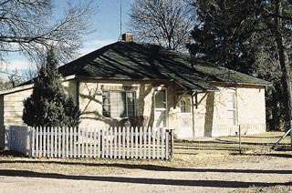
The Brookside farm (also known as the Gridley-Howe-Faden-Atkins Farmstead), illustrates an historically typical farmstead evolution in Nebraska. Listed on the National Register of Historic Places Brookside Farm

Attractions and Upcoming Events

Panorama Point and Three-State Marker

In the extreme southwest corner of the county, thirty three miles from Kimball, rises the highest point in Nebraska. This site, 5,424 feet above sea level, looks more like a rise in a pasture than the highest point in the state.

Kimball, NE Natural Attractions

Tri-State Corner Marker

The original marker designating the southwestern corner of nebraska and the southeastern corner of Wyoming where they meet the Colorado line was erected on august 17, 1869 by Oliver N. Chafee. The marker had only "Colorado" (then a territory)

Kimball, NE Landmarks


Maginnis Irrigation Aqueduct

The Kimball County Irrigation District Board held its first organizational meeting in November 1909

Kimball, NE Structural Landmarks

The Stone Building

The Stone Building is a two-story structure built in 1893-94 of rough-cut, locally quarried limestone. Listed on the National Register of Historic Places

Kimball, NE Historic Buildings

Things to do near Kimball, NE

Oregon Trail Wagon Train

Experience the real West in the shadow of Chimney Rock aboard a prairie schooner on the Oregon Trail. Exciting journeys, comp...