Historic Route 66 -
category : Landmarks
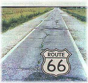 The "Mother Road" inspired books, songs, and a television series. It stretched from Lake Michigan to the Pacific, dotted with mom and pop businesses. Route 66 was rendered obsolete by interstate highways, but travelers are re-discovering its charm as it winds through cities and towns, past generations and old landmarks. Oklahoma has more miles that can still be driven than any other state.
Now keep an eye on your odometer, because precisely one mile from the distance marker in Afton is the turnoff to one of the rarest stretches of historic highway anywhere on Route 66.
Built by the Oklahoma Department of Highways in 1922 as part of Federal Aid Project #8, this unorthodox section that connected Afton with Miami was paved only nine feet wide, including concrete curbs. Surviving blueprints reveal that plans were originally drawn for both a standard eighteen-foot roadway and the nine-foot roadway, but the circumstances that influenced the outcome remain unclear. One story suggests that the funding provided allowed for the completion of a standard road only half the distance, and that state highway officials elected instead to build it the entire length, but just half as wide. This would get the job done without violating federal regulations.
In any event, the result is still visible today, and can be driven, with care, for several miles.
The first thing you will see here is a strip of old road that simply loops off the current route on the right for about a hundred yards, then cuts back in. Directly across from this crescent-shaped piece of concrete the nine-foot road heads north, appearing at first to be only a dirt road. The old pavement soon reveals itself, though, and you can trace this historic section for three miles, until it intersects the current route at a stop sign next to the Northeast Vo-Tech school.
If you'd rather stay with current Route 66 at this turnoff, take the highway around the curve to the left and go past the junction for U.S. 59. Next you'll cross a bridge over some railroad tracks, then come to a sign for U.S. 60 East. Avoid this turnoff, staying on Route 66, which is known here as U.S. 69 and U.S. 59. Momentarily you will pass underneath the U.S. 60 bridge and then the turnpike. Up ahead on the left is the Vo-Tech school, where Historic Route 66 intersects on the left.
From there, cross the open range to Narcissa. This is a wisp of a town with only one main crossroad next to the Sinclair station, where the distance marker is located on the map. Exactly one mile north of this intersection you will see a house on the left and a road to the right. This is the turnoff to the remainder of the nine-foot wide highway, which goes all the way to Miami.
To follow it, turn right for a mile, then left for another, then right again until you come to a residential area, where the pavement is now coated in asphalt to a normal width. Turn left here onto E. St. SW and continue into town, passing the old FFA exhibition building on the right. After a bend in the road at the park, you will cross a bridge over the Neosho River, then curve to the left, where E. ST. SW becomes South Main St. At the traffic light ahead you will intersect U.S. 69, or Steve Owens Blvd., where the current route connects from the west and the distance marker for Miami is located on the map. To continue through town, keep going straight at the intersection, heading north.
Come visit us in Oklahoma, Oklahoma