
Baxter Springs, Kansas
Tri-State Marker
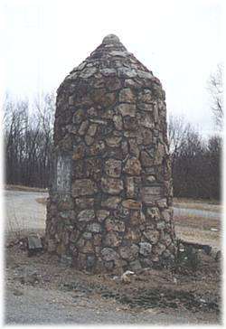 See the Tri-State Marker and be in three states at once! The meeting point of Kansas, Oklahoma, and Missouri is 6 miles east of Baxter Springs on Highway 166/400. Turn south on the small paved road ju...
Tri-State Marker