LASR.net Homepage


Menu

Bank of Protection Ashland, Kansas

Ashland, Kansas

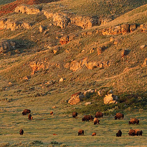
Big Basin is a large circular depression. It is about one mile in diameter and about 100 feet deep. The walls of the basin are nearly vertical. Scattered across the floor of Big Basin are a number of small ephemeral ponds that catch and temporarily hold the water that flows into the basin.

U.S. Highway 283 bisects Big Basin, with approximately two-thirds of the basin lying east of the road and within the confines of the preserve. The remaining western third of the basin is privately owned.

Attractions and Upcoming Events

Big Basin Prairie Preserve

Big Basin is a large circular depression. It is about one mile in diameter and about 100 feet deep. The walls of the basin are nearly vertical. Scattered across the floor of Big Basin are a number of small ephemeral ponds that catch and temporarily hold the water that flows into the basin.

Ashland, KS Nature Preserves


Clark County State Lake

Clark County Lake is nestled in a rugged area of Clark County north of Ashland. This 337

Ashland, KS Recreation

Old Stockgrowers Bank

The Old Stockgrowers State Bank Building is registered as a historic landmark by the United States Department of Commerce.

Ashland, KS Historic Buildings

Things to do near Ashland, KS

Jetmore City Lake Fishing Report

WHAT TO KNOW ABOUT ACCURATE FISHING REPORTS: This is just to remind you that fishing reports are given with the bes...

Protection Golf Course

The Protection Golf Course has nine all grass greens and tee boxes. ...